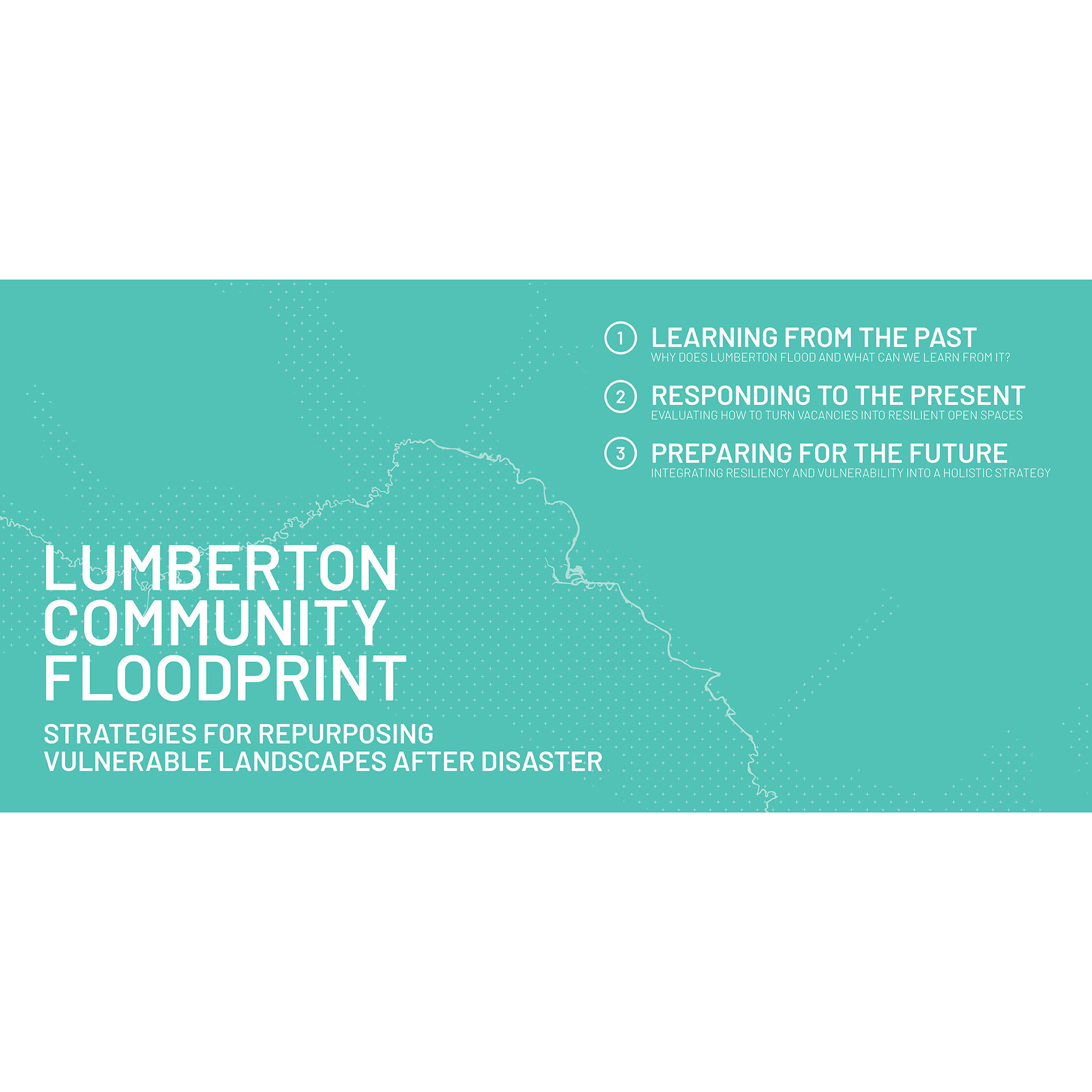
Project Summary
Recent efforts undertaken by the Coastal Dynamics Design Lab (CDDL) have provided the City of Lumberton with design and planning technical assistance focused on land-use recommendations and design strategies for vacant parcels resulting from catastrophic flooding. The products of these efforts—Phases 1 + 2 of the Lumberton Community Floodprint—propose methods that strategically combine FEMA acquisition properties (i.e., “buyouts”) with existing parks and recreation assets to create a connected system of educational, recreational, and environmental amenities in areas that are otherwise vulnerable to environmental hazards, vacancy, and neglect. Outcomes of this research show strong potential to reduce flood risk and enhance public safety associated with repetitive flood-loss properties and improve long-term environmental function within historically flood-prone areas.
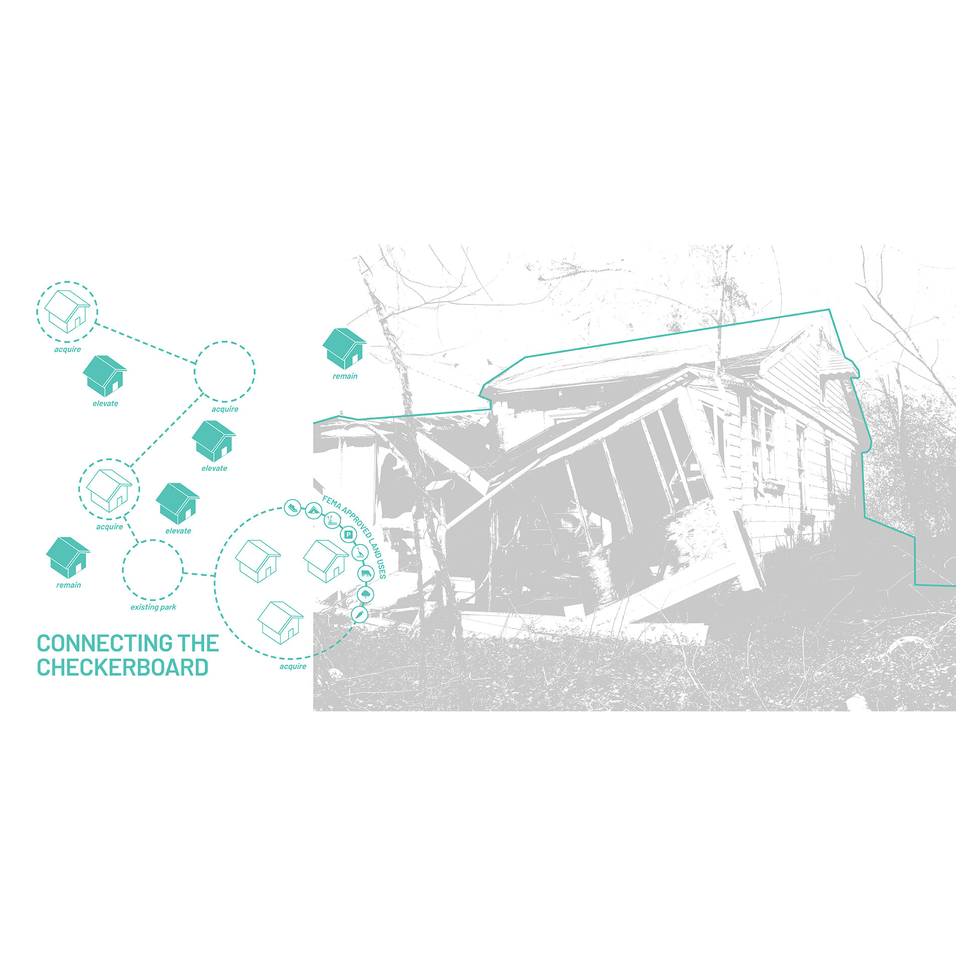
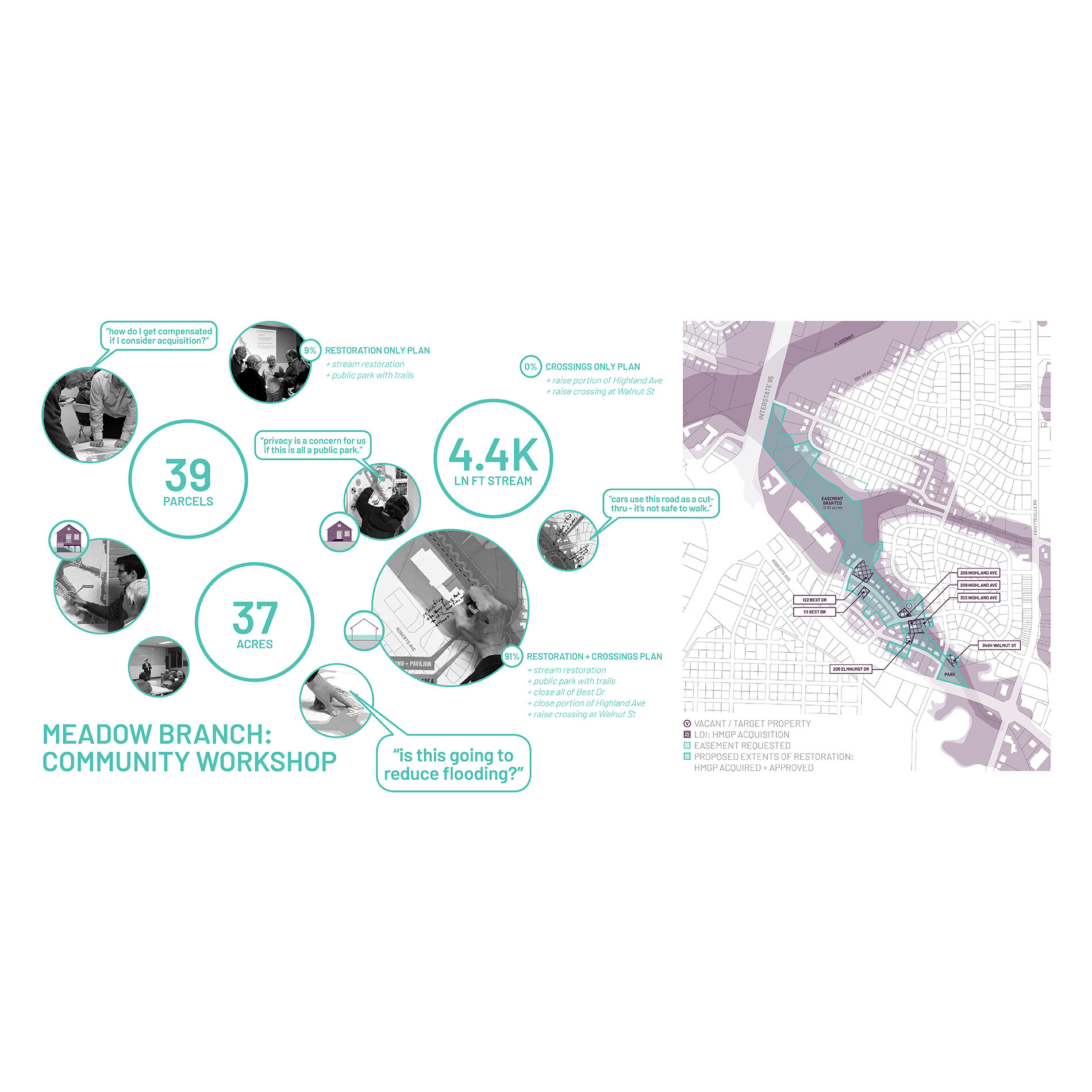
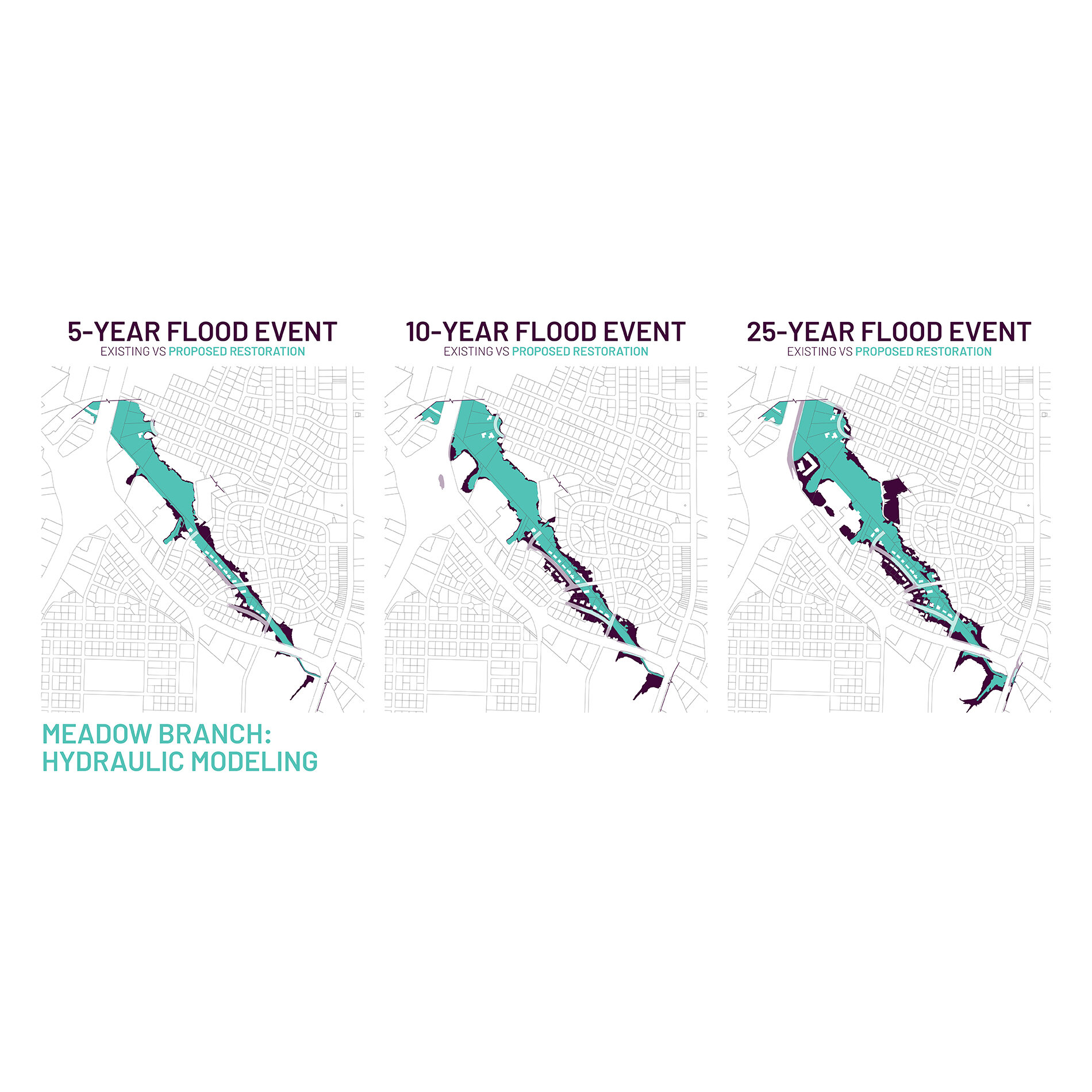
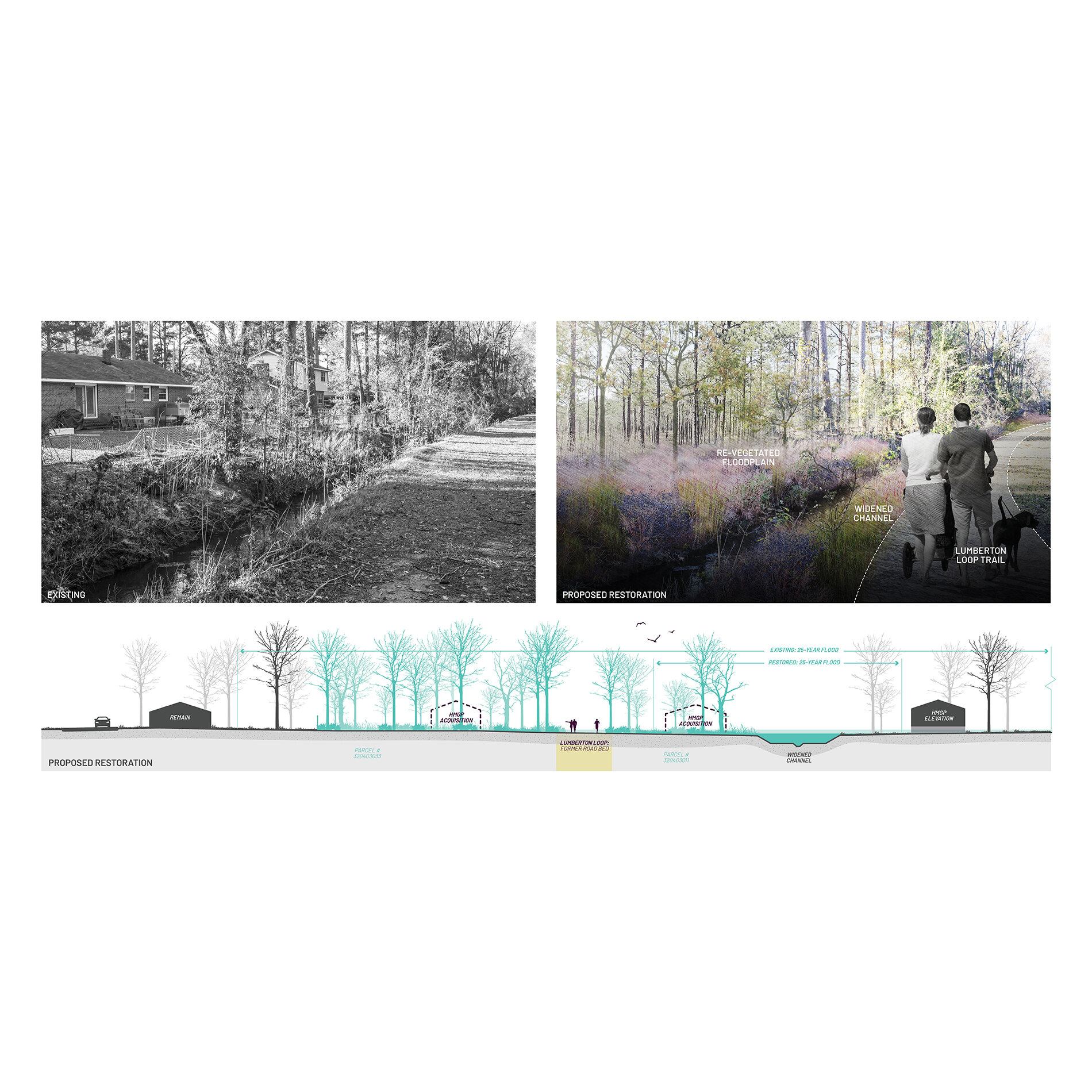
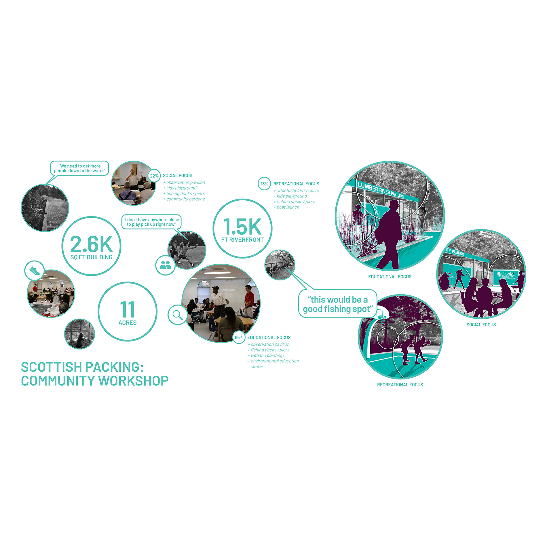
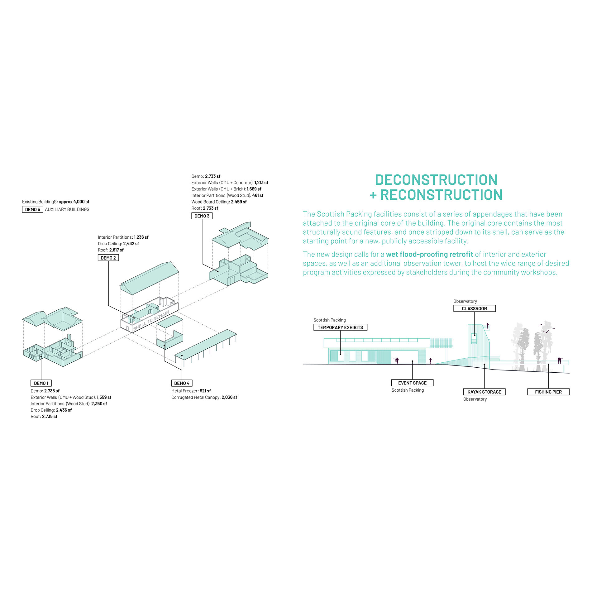
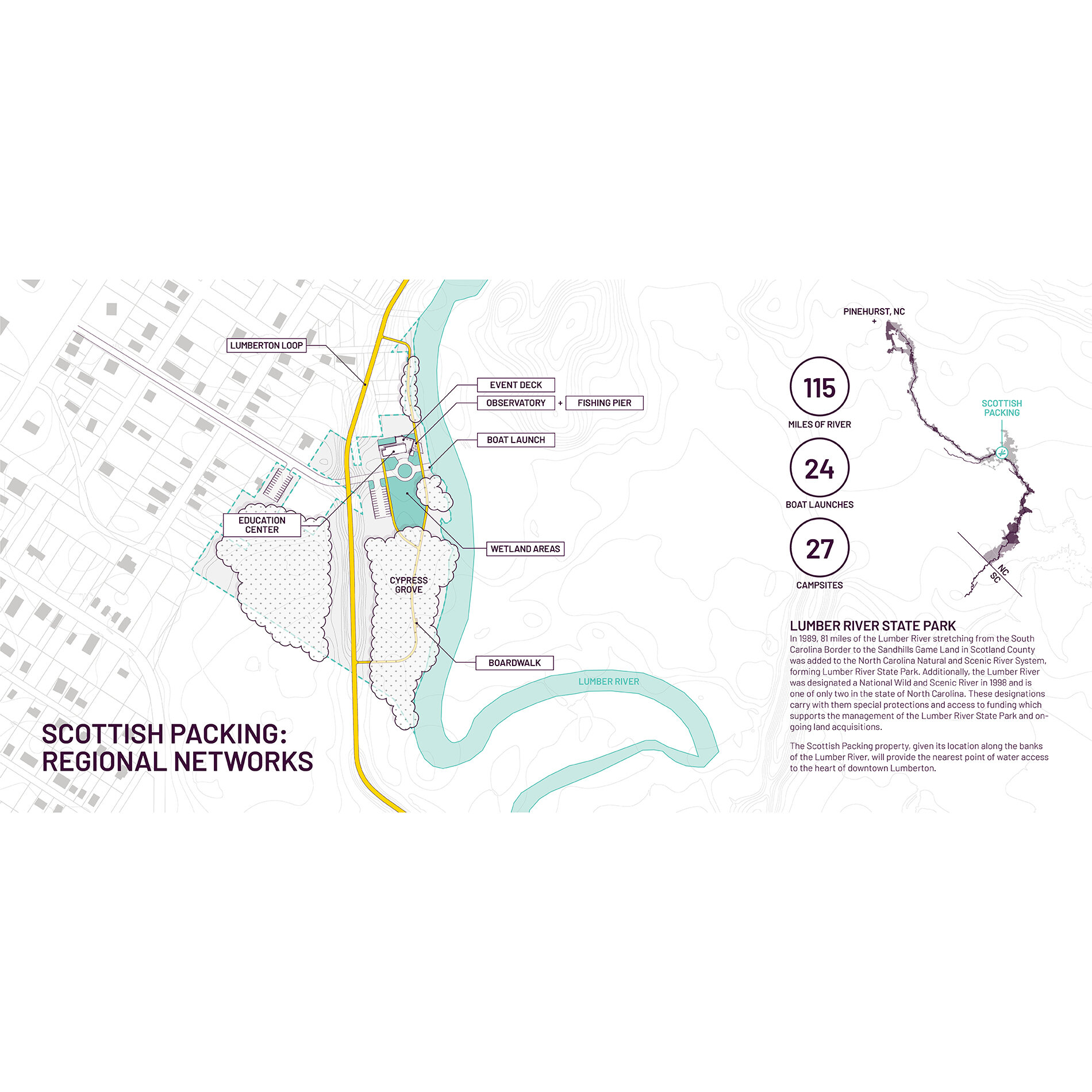
The research findings and recommendations generated in Phase 1 of the Lumberton Community Floodprint were disseminated to community leaders via a presentation to the Lumberton City Council (March 19, 2019). This presentation was the culmination of a year-long, collaborative research and planning process. The Phase 1 study informed key discussions with community leaders and, ultimately, served to generate interest in pursuing a select number of the report’s proposals. The primary outcome was the adoption of the Lumberton Loop Plan, including a request from city leaders, staff, and project partners to conduct additional research, engagement, and design assistance for two flood-impacted areas on the route. The two neighborhood projects include: 1) Meadow Branch Floodway Restoration adjacent to the Best Drive neighborhood, and 2) Repurposing the Scottish Packing Plant property into a recreation and environmental education amenity associated with the Lumber River State Park and/or North Carolina Wildlife Resource Commission. These places and projects are the focus of this Phase 2 report.
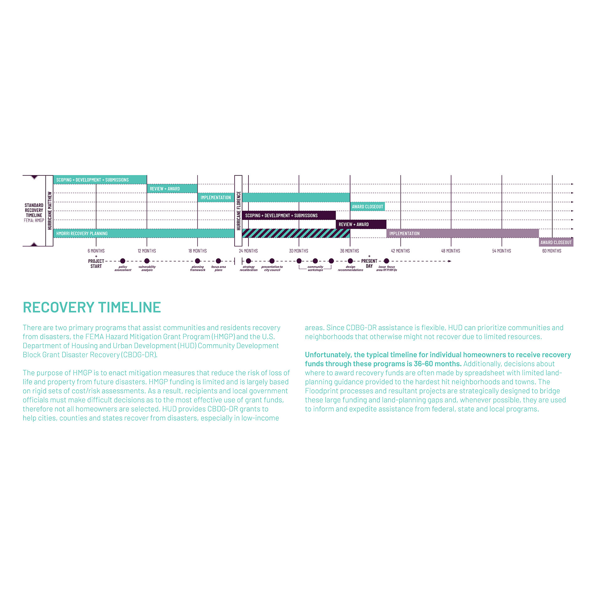
Phase 2 of the Lumberton Community Floodprint completed research, engagement, design, and communication activities including but not limited to: [1] two community meetings in each project area (four total) that elicited participation and input from neighborhood residents and one meeting with city council/staff to present findings and recommendations for both projects; [2] hydraulic modeling and development of conceptual restoration concepts for the Meadow Branch; [3] development of schematic design alternatives for both project areas to be used by the city as evidence/leverage for seeking larger implementation grants and to inform respective requests for proposals (RFPs); and [4] continued evaluation of issues and opportunities related to both Hurricane Matthew (2016) and Hurricane Florence (2018) impacts (i.e., FEMA flood map updates, incorporation of new property acquisition data, etc.), including associated updates and revisions to the Phase 1 Lumberton Loop Plan.
The goals of all processes undertaken and products delivered by the CDDL and its partners are to: [1] reduce the impacts of environmental hazards, specifically flooding; [2] increase public access to the benefits of nature and recreation; [3] meaningfully engage with local residents and regional stakeholders, including serving vulnerable neighborhoods through participatory activities; and [4] develop feasible, contextually appropriate and high-performing designs for each of the focus areas.
Awards
Honor Award: Analysis & Planning
National ASLA | 2020
Award of Excellence: Analysis & Planning
ASLA Southeast Regional Conference | 2019
Funding Sources
Full Report
FEMA BRIC Program Case Study
Lumberton Loop: A City-wide Plan for Flood Mitigation, Restoration, and Recreation
Sample Images