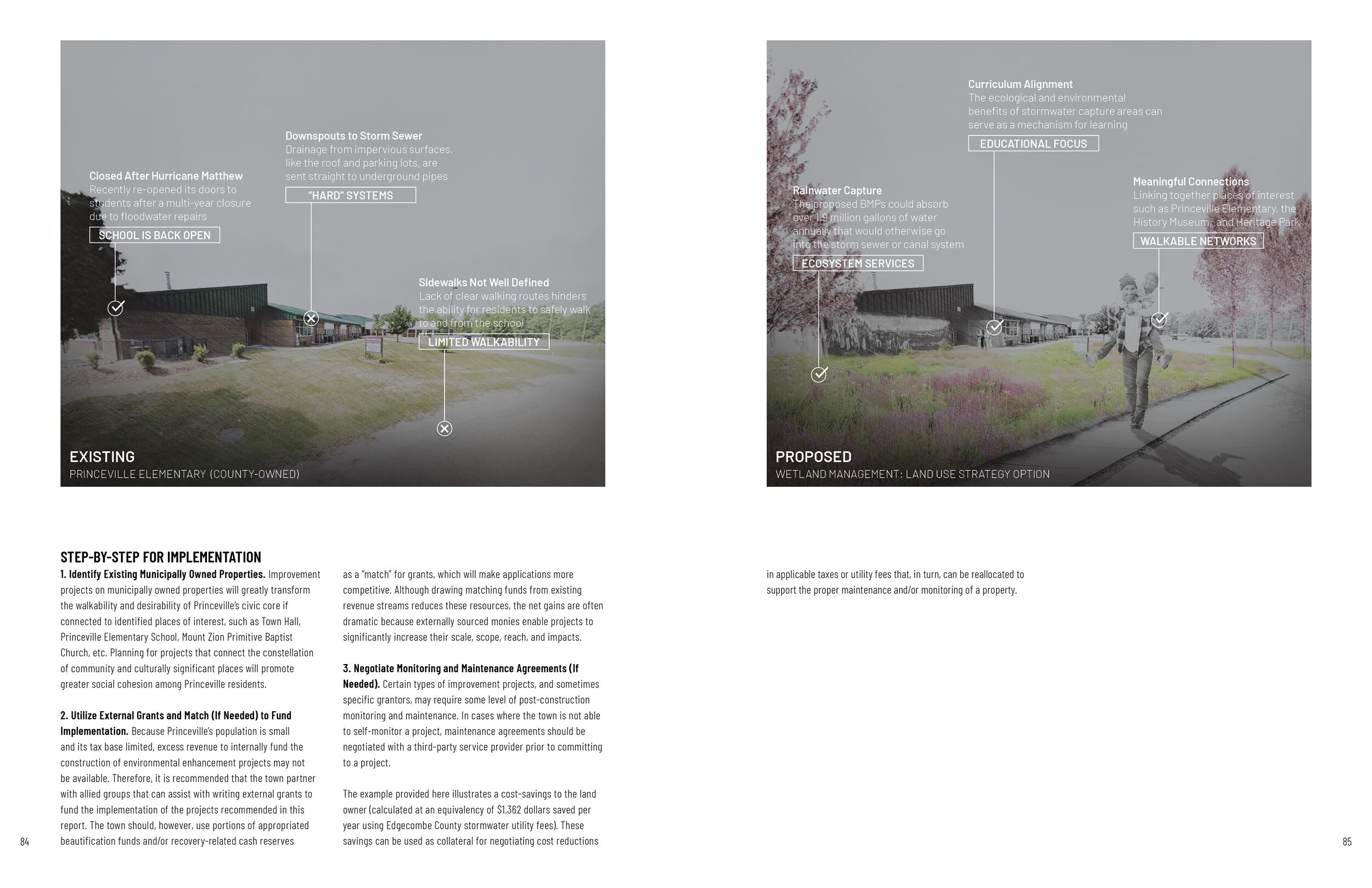
Project Summary
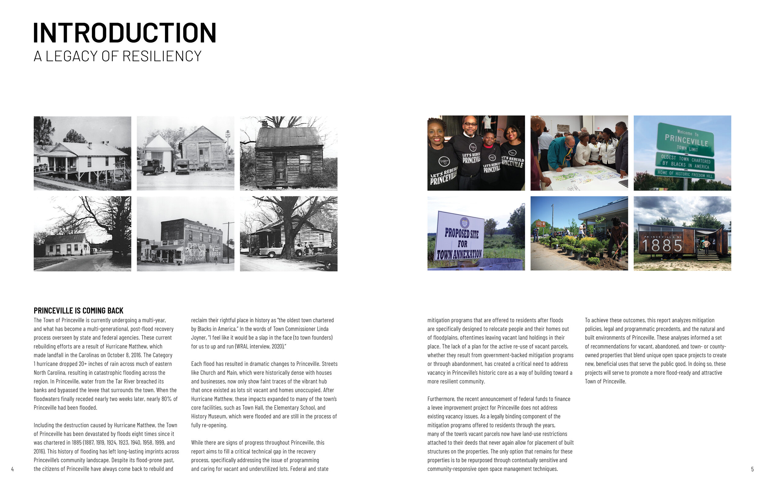
Since its founding as Freedom Hill in 1865, Princeville has survived the violence of Reconstruction, the institutionalized discrimination of Jim Crow, the destructive forces of urban renewal programs, and multiple devastating floods. Resilience has long characterized this community. Flooding after Hurricane Matthew in 2016 left an estimated 80% of the town underwater, and Hurricane Floyd eighteen years earlier was worse. Princeville’s vulnerability to floodwaters, even with a three-mile earthen levee in place, has prompted recommendations that the community relocate to higher ground. However, its irreplaceable, place-based history makes this an impossible proposition.
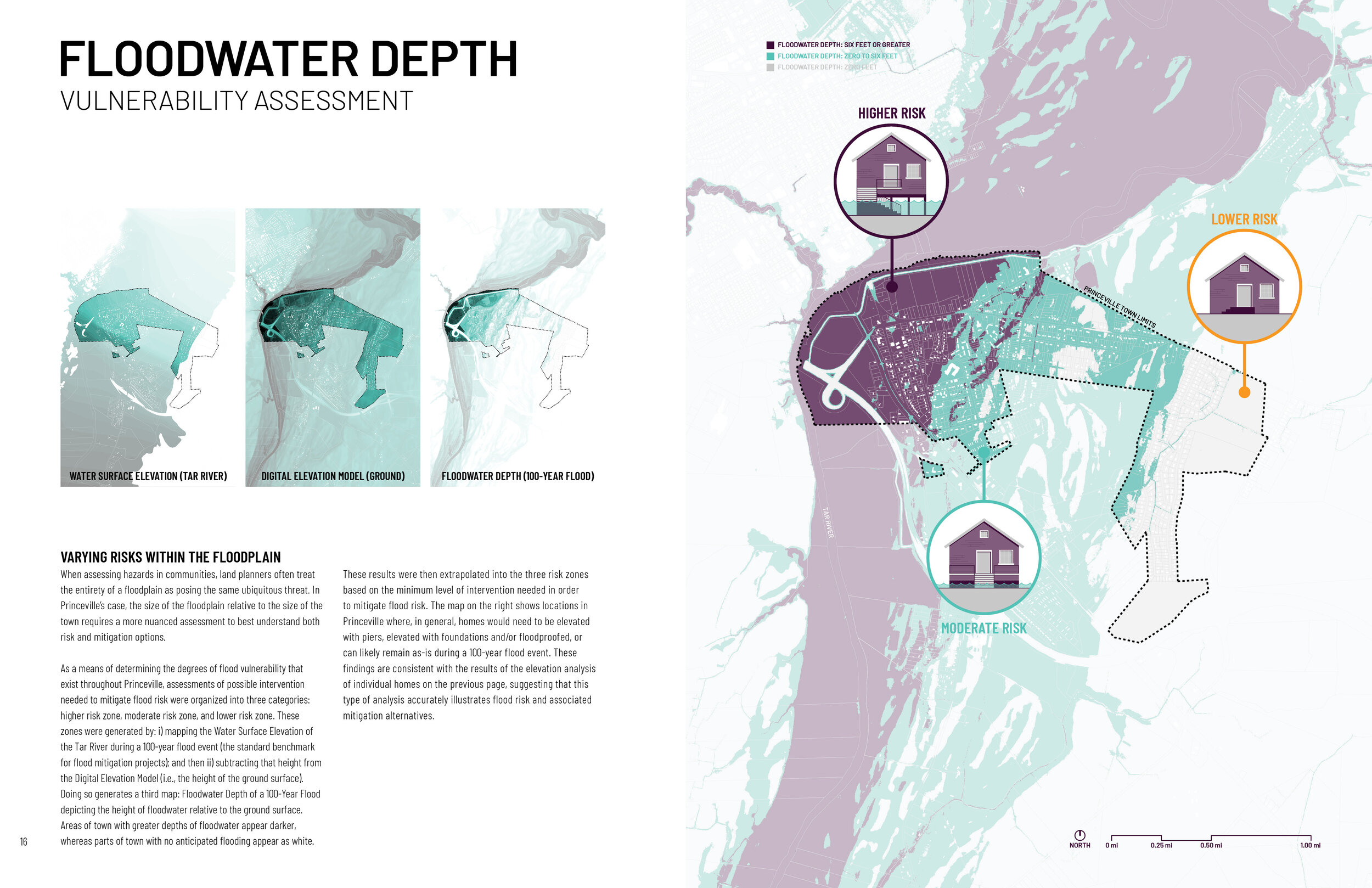
In a continued effort to reimagine and rebuild a more flood-resilient Princeville, this study used an environmental and community planning approach referred to as “floodprinting.” The process of developing a community floodprint is guided by land/water relationships, including the powerful forces associated with flooding.
The Princeville Community Floodprint is the result of interdisciplinary work completed by the NC State University Coastal Dynamics Design Lab alongside multiple project partners spanning local and regional governments, non-profit organizations, land trusts, community activists, and state recovery agencies. It reflects the combined expertise of landscape architects and environmental planners who have applied best practices in design and planning to develop landscape analysis, planning, and design strategies that respect and reflect Princeville’s local character and history. The goal of this project is to help increase social and physical resilience in Princeville, specifically through recommending land-use strategies that reduce flood risk, recognize capacity gaps, and improve public safety, environmental awareness, and long-term ecological function within historically flood-prone areas.
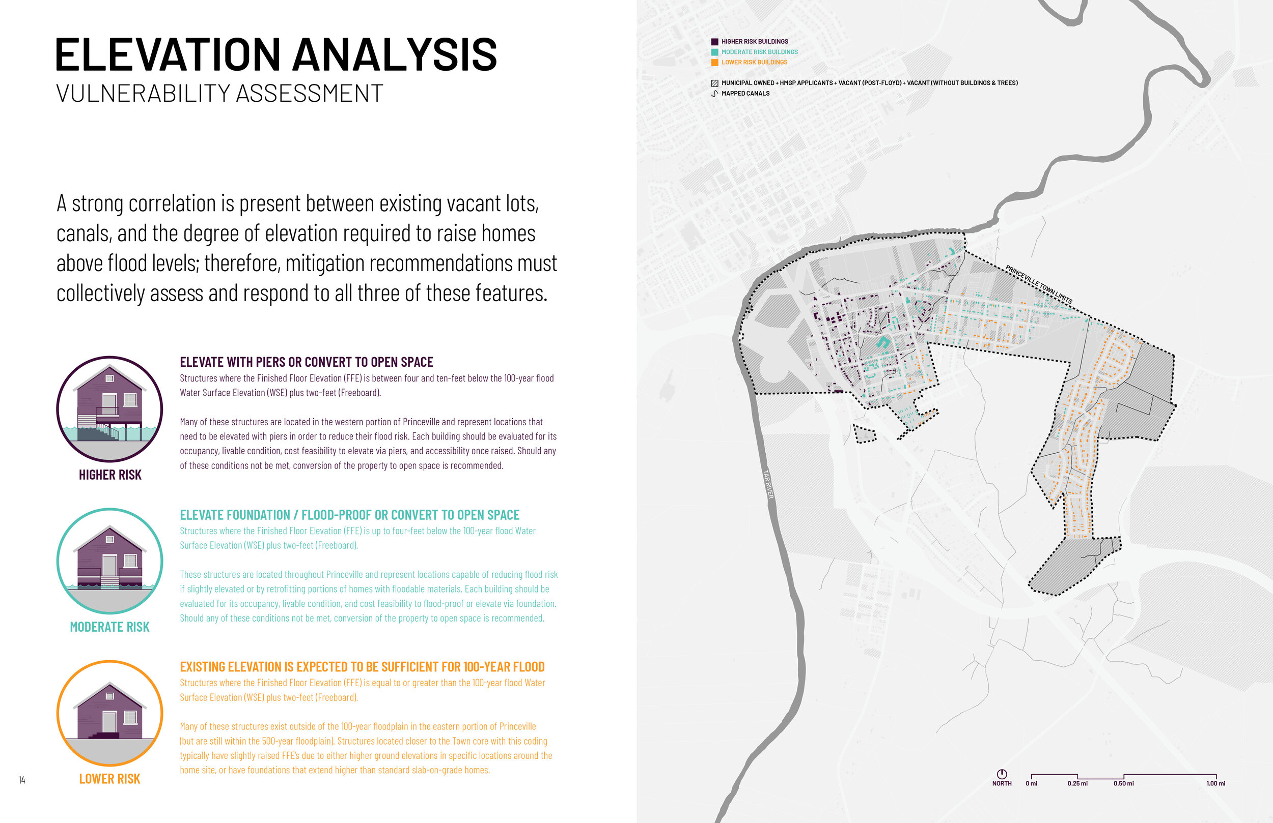
This report does not offer solutions to keep floodwaters out of Princeville. Rather, it recognizes the cultural significance of the Tar River floodplain lands, and offers land planning approaches that enable the community to adapt in-place. Recommendations included in the report are categorized around three primary themes: conservation, cultivation, and wetland connections. These categories strategically align with FEMA-approved land uses that regulate how parcels can be used post-buyout. Nested within each of these thematic areas are specific projects that focus on the repurposing of vacant, vulnerable, and underutilized parcels that all fit within a unified plan. The plan also organizes proposed projects and programs by immediate-, near-, and long-term initiatives. The final Princeville Community Floodprint contained herein was approved by the Town of Princeville Planning Board (September 17, 2020) and formally adopted by the Town of Princeville Board of Commissioners (September 21, 2020). This collaborative effort contributes to the collective, growing body of post-Matthew recovery work that is both specific to Princeville and aspires to serve as a model for resiliency and recovery work across North Carolina and the Eastern seaboard.
Funding Sources
The Conservation Fund (direct sponsor), in collaboration with the Conservation Trust for North Carolina and North Carolina Community Development Initiative
Full Report
Sample Images